Jennifer Crump was walking around Wapato Hills Park in Tacoma when she had an epiphany.
“I realized how close the park was to Edison Elementary School,” Crump explains, “and I wondered if those folks realized how close they are to this cool resource.”
As the K-12 Science Instructional Facilitator for the Tacoma School District, Crump supports the district’s science curriculum and instruction needs and provides materials and guidance for educators. “I started thinking, ‘Wouldn’t it be nice if there was a map that could show all the green spaces within walking distance where teachers could take students to engage in experiential learning?’ That’s when I remembered Daniel.”
“I’m interested in connecting students to our city so they can see science learning as an empowering way to make Tacoma a better place. Science isn’t just something that’s done in the classroom for school but something we can use to impact our community. This [map] is a great first step.”
— Jennifer Crump, K-12 Science Instructional Facilitator Tacoma Public Schools
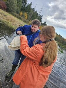
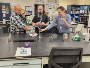
Over the past year, Tacoma teachers have participated in multiple Explore the Salish Sea workshops co-facilitated by PEI’s East Sound South

FieldSTEM Coordinator Daniel Cuevas. Cuevas is skilled in developing maps and other materials with Geographical Information Systems (GIS), computer-based tools used to store, visualize, analyze and interpret geographic data.
Crump’s map idea fits well with the final unit in Explore the Salish Sea’s curriculum. Previous units introduced the issue of declining resident orca populations in Puget Sound due to environmental challenges and explored topics like migration and water quality. The culminating unit calls for students to take action based on their review of the science and traditional ecological knowledge recommendations they have made after each scientific investigation in previous units.
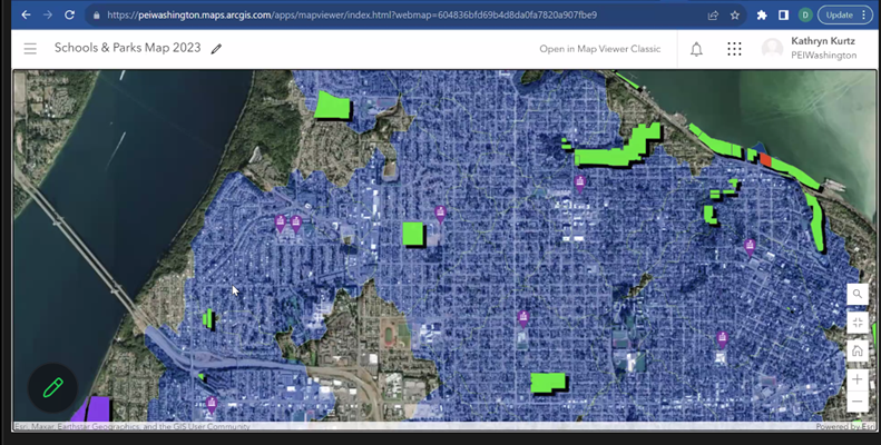
“Students and teachers try to figure out ways in their communities or on their school grounds that they can do projects to bolster habitat and the environment for orcas,” Cuevas says. “Jennifer asked me for a map of parks or green spaces within a 15-minute walk of each elementary school so that teachers can visit places where they could implement a project.”
Cuevas put an interactive map together quickly. “He jumped right on it,” she laughs. “A short time afterward, we met at a professional development session and he said, ‘Here’s the link to the map.’ It’s such a fantastic resource. I’m interested in connecting students to our city so they can see science learning as an empowering way to make Tacoma a better place. Science isn’t just something that’s done in the classroom for school but something we can use to impact our community. This is a great first step.”
Some teachers will be early adopters of the map, Crump foresees, while others may need support to use it to its fullest potential. She expects

the map to get a lot of use in the spring to support elementary school science units. “The possibilities are endless,” she says. “I’m thinking about the professional development opportunities I can offer and ongoing support for curricular connections.”
She’s already requested similar maps for the district’s middle and high schools, and other districts have expressed interest as well. Cuevas believes the map can be a powerful tool for helping teachers get over any intimidation they might feel about taking students outdoors.
“It really helps having the information in one spot,” he notes. “They can click on their school and find out which parks are closest. It takes care of some of that work and increases equity. They don’t have to take their students somewhere across the city when there are places they can go right in their own neighborhoods.”
